

Neeld Estate
Charm of the Chesapeake
photo: Eve Shoemaker
INFORMATION

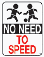
Please drive gently and cautiously through the community and always anticipate that the 'little people' are fixed on having fun and are not looking out for the 'big people in cars'.
DID YOU KNOW??
Nearly 95% of the land
in Maryland drains to
the Chesapeake Bay

The Neeld Estate beach is PRIVATELY OWNED by the Neeld family and can only be used by Residents of Neeld Estate and their Guests Anyone else is TRESPASSING on Private Property "Violators will be prosecuted by authority of Plum Point Corp."
(Posted on the signs leading to the beach)
WARNING: NO PARKING at the Beach Entrances
Chips Towing - 410-257-6121 or 301-855-8343
Please take the time to read the signs posted at the entrances to the beach... and please be a good neighbor and follow the rules as they are posted.
(This sign was posted by Plum Point Development Corp.,
(the Neeld family owns the beach)


Attention Dog Walkers:
"If your dog leaves it. . . Please Retrieve it" SCOOP the POOP - It's A Law
Help keep our pets from polluting the Bay. Pet Waste is one of the major contributors to Bay pollution. The "Mutt Mitt" Doggie Bag Dispensers have been installed, one at each of the main entrances to the beach. Hopefully this will encourage all dog walkers to pick up after their pets.
Steamboat Wharves & Landings of Calvert County

Calvert County has a Leash Law for pets. This law applies to EVERYONE- residents & guests in
Neeld Estate. There have been many complaints from property owners about the dogs running loose in the neighborhood and on the beach.
PLEASE obey the rules 410-535-2800 - Call to report loose animals. Calvert County has a leash law for DOGS, meaning
if a dog is off the owner's real property, it must be on a leash. There is also a control law for CATS, meaning if a cat is off the owner's real property, it must be under a person's control.
Calvert County Animal Control Regulations
Defecation, Removal of Excrement
A. NO person owning, keeping or having custody of a dog or cat shall allow or permit excrement of such animal to remain on public property, private property without the consent of the owner or occupant hereof or allow the excrement to cause foul odor on the owner's property.
B. Any person owning, keeping or having custody of an animal shall immediately remove the excrement deposited by the animal if deposited on property other than the owners.
NECA MEMBERSHIP
FULL MEMBER - $50.00
an owner of property located in Neeld Estate
ASSOCIATE MEMBER - $7.00
a relative of any member of NECA, at least 18 yrs of age
AFFILIATE MEMBER - $20.00
a tenant resident in Neeld Estate who has rented or occupied property with a lease for at least 1 year
These dues are PER YEAR
Contact: Kim Phillips, NECA Treasurer
Calvert County Critical Area Program
What You Need To Know:
ALL of Neeld Estate is in the Critical Area. . . Every Property
A map, outlining the Critical Areas of Calvert County is posted in the Planning & Zoning Office in
Prince Frederick.
The Critical Area for Neeld Estate extends all the way to Tobacco Road.
(Our community is surrounded by water)
This land is 'critical' because the health of the Bay, including the plant and animal life living in it is
impacted by what you do on your property.
What Activities Are Regulated in the Buffer?
* No cutting or clearing is allowed without a permit.
* No structure or building is allowed without a permit.
* Grading, adding fill material, or shore erosion control methods require permits.
* Dead trees may be removed without a permit.
* Trees posing immediate threat to a structure may be removed without a permit, but with prior Planning
& Zoning approval.
* The lower one-third of branches on mature trees may be pruned without a permit, but with prior Planning and
Zoning approval.
* Invasive vines may be removed without a permit, but with prior Planning & Zoning approval.
* Maintenance of existing lawns is permitted.
* Stiff penalties are imposed for unauthorized clearing in the buffer zone.
1. What is the Critical Area?
In 1984, the Maryland General Assembly resolved to reverse the deterioration of the Bay’s environment by enacting the Chesapeake Bay Protection Act. In 2002, the Act was amended to include the Atlantic Coastal Bays. The Act required the 16 counties, Baltimore City, and 44 municipalities surrounding the Chesapeake and Atlantic Coastal Bays to implement a land use and resource management program designed to mitigate the damaging impact of water pollution and loss of natural habitat, while also accommodating the jurisdiction’s future growth. The Critical Area Act recognizes that the land immediately surrounding the Bays and their tributaries has the greatest potential to affect water quality and wildlife
habitat and thus designated all lands within 1,000 feet of tidal waters or adjacent tidal wetlands as the “Critical Area.”
2. Who and What does the Critical Area Act affect?
The Act affects all those who live or own property within 1,000 feet of tidal waters or tidal wetlands.
All development or use of land located within the Critical Area is affected in some way. Just because land is in the Critical Area however, does not mean it can’t be developed and used
3. What is the Critical Area Commission and how does it affect me?
The 29-member Critical Area Commission was created by the 1984 Chesapeake Bay Protection Act to design the Critical Area Criteria which are the basis of 63 local Critical Area Programs. The Commission reviews and approves local jurisdiction Critical Area Programs and amendments to those programs. The Commission staff reviews and comments on subdivisions, site plans, variances and other local development proposals within the Critical Area. While a State agency, the Critical Area Commission reviews and comments on development proposals within the Critical Area. Each local jurisdiction
maintains sovereignty in creating, adopting, and implementing its local program in accordance with the Commission’s Criteria.
Did you know Steamboats came to Plum Point in the 1800's
The original road to the Plum Point Wharf followed a tobacco rolling road around the ridge that ran parallel
to the shore about 300 feet north of the end of Plum Point Road. There was steamboat commerce from Plum Point at least after 1819, but the goods and passengers were probably transferred by lighter. The first wharf was most certainly in use by 1859.
The wharf at Plum Point was a bustling commercial center that included a warehouse, Plum Point Store, a post office, a passenger terminal building, and a cannery. The first general store was actually two Civil War-era buildings---a warehouse and a slave dwelling. After 1893, the store was expanded on the east side and a large porch was built across the front of the structure. One account reports, "the store was the hub of the community, a gathering place for both blacks and whites, and everyone who knew it holds their own special memories." The store was an important gathering place for more than just trade. There is an interesting story from the Civil War era---two Confederate soldiers were in the Plum Point store when they were alerted to the presence of Union soldiers. The Confederate men quickly went up into the attic and changed their clothes. The men hid their swords under the floorboards of the attic. Their swords were found there decades later.
Sea Nettles Probability of Encounters (Experimental)
The jellyfish often encountered in the Chesapeake Bay in the summer is the sea nettle Chrysaora chesapeakei. Knowing where and when to expect this biotic nuisance may help to alleviate an unpleasant encounter.
Unless you are in a dark purple region you may encounter your first sea nettle of 2020, unless you already have. I use this map frequently so I know whether or not I can afford to fall off the paddle board! It’s updated daily. I’ve noticed that in onshore breezes, they swim away from the shore.
Update on DNR and the Hydraulic Clam Dredgers
The Plum Point Oyster Sanctuary runs parallel to our shore from Camp Roosevelt to Dares Beach covering over 6,000 acres. Last year clam dredgers dredged razor clams from May to October with very little patrolling by MD DNR. We had one officer for the county and they answer calls for everything from roadside deer poachers to washed up paddle boards. They were very understaffed.
This year we have a new officer. Officer Lopez. She has two officers helping her. She was unaware of last years issues with the dredgers working in and around the sanctuary which is off limits to dredge boats.
Hydraulic clam dredging is very destructive to the bay’s bottom, destroying any grasses and sending silt in huge plumes that can suffocate oysters. It is also not sustainably managed. Clam dredging, where legal, is allowed year round, seven days a week, sun up to sun down, no limit on catch, and no limit to how loud the boats can be and they are really loud!
Our sanctuary boundary begins just offshore and is poorly marked by moving markers that have not been reset in years. The boats are not allowed to dredge beyond the boundary markers. Other sanctuary boundaries run to the shore line but ours does not. This seems to be a loophole for a free for all for these boats that mostly come from the Eastern Shore where most of their clams are depleted and they are finally enforcing the new SAV (sub aquatic vegetation) zone boundaries.
MDE is going to be resetting the markers and adding new ones. If you have one as a lawn ornament and would like to give it back please let me or Officer Lopez know. They will not just go around taking them.
Officer Lopez has been patrolling and warning the boats but they continue to return and leave when they see the DNR boat leaving the marina. She would appreciate photos and videos if they prove the boat is dredging the sanctuary. That is difficult without markers in the picture. Drones are useful, especially in the case of the photo of a boat making a silt plume. Those photos are useful for showing legislators and the public an example of the environmental destruction.
There are many great and honest watermen out there and being the seafood lover I am, I appreciate them very much. However, crabs, rays and other wildlife feed on the clams and when the clams disappear so do they. It’s happened over and over in other parts of the bay.
If you want to report-
DNR Dispatch 410-295-4663
Our local officer-
Officer Lopez cell 914-912-6938
If you want to let DNR know your thoughts, please call the MD DNR Program Shellfish Division director
Chris Judy 410-260-8259
It would be great if you want to share this with friends in the other communities that are along the shore.
Thank you!
Lisa Collins


Dear NECA Members:
National Hurricane Preparedness
The link provides helpful tips for this type of weather occurrence.
Please share as appropriate.
https://www.weather.gov/wrn/hurricane-preparedness
email received from Janet Gean
Calvert Recorder Story:
Bay crossing maps prematurely surface to reveal Calvert options


Map showing proposed sites for a new Chesapeake Bay Bridge.
Plum Point Road is #11
I'm a paragraph. Click here to add your own text and edit me. It's easy.